 |
|
History of the Baygitano
The Baygitano is another
much-dived UK wreck and a relatively easy dive for any sports diver. She
lies in a maximum depth of 22m with the top of the wreck some 5-6m off the
seabed. Her position can be found at GPS co-ordinates 50 41.71N 2 55.96W
which is only about 1.5 miles south of the harbour at Lyme Regis. This
wreck is easily reached by even the smallest of diving inflatables.
How did she sink?
Sunk by torpedo during the first
world war, it is well broken, mostly flat apart from the boilers. She is
always covered in thousands of fish. If you venture off at the stern to
the south, there is a smaller section of the wreck detached from the main
wreck.
Dive Guide
To be completed.
General Info
| Co-ordinates: | 50 41.71N; 02 55.96W |
| Slack water: | |
| Getting
there: |
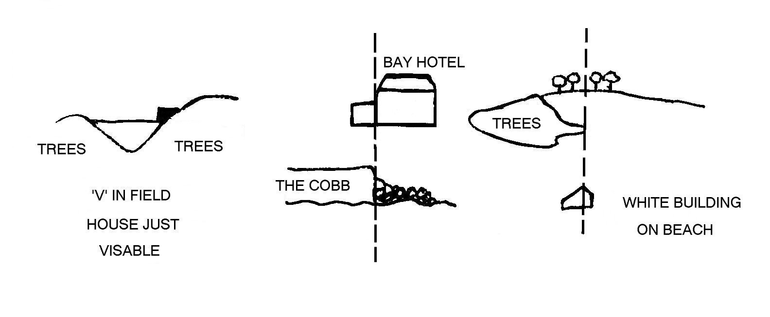 |
| Diving
and air: |
|
| Launching:
|
|
| Accommodation:
|
|
| Qualifications:
|
|
| Further
information: |
|
| Pros:
|
|
| Cons: |
 Copyright © 2007 Chippenham Diving Club - BSAC1622 |